Complete Guide to Hiking Devils Punchbowl Conservation Area on the Bruce Trail Niagara Escarpment
Executive Summary: Mastering Your Next Adventure Along the Niagara Escarpment
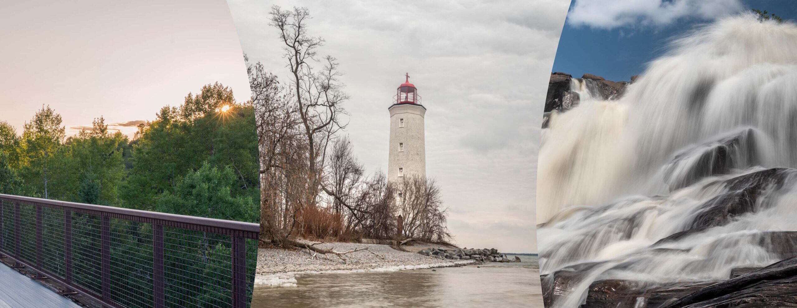
Looking for an unforgettable outdoor adventure in Ontario, Canada? Read our ultimate guide to hiking Devils Punchbowl Conservation Area on the Bruce Trail Niagara Escarpment. This complete guide provides trail maps, parking tips, geological history, and expert secrets for exploring Stoney Creek’s famous dual waterfalls. Discover the 33.8-metre Upper Falls and the 5.5-metre Lower Falls, learn about the rare Ordovician and Silurian stratified rock layers, and view spectacular lookouts over Hamilton Harbour. Whether you are planning to track the spring raptor migration, explore the 11.5-kilometre Dofasco 2000 Trail boardwalk through the Vinemount Swamp Forest, or conquer the challenging Bruce Trail side paths, our comprehensive, SEO-optimized overview ensures you possess all the essential information for a safe, breathtaking journey along this world-renowned UNESCO World Biosphere Region landmark.
Devils Punchbowl Conservation Area: A Geological Masterpiece in Ontario
When the weekend arrives, outdoor enthusiasts across Ontario are constantly searching for unique landscapes that combine deep natural history with breathtaking views. It is globally recognized that the Niagara Escarpment serves as a pristine backdrop for some of the most dramatic terrain in Canada. Nestled within this breathtaking environment, the Devils Punchbowl Conservation Area stands out as an absolutely magnificent destination for hiking. Managed carefully by the Hamilton Conservation Authority, this pristine sanctuary is visited by thousands of nature lovers annually.
                                 [ Ridge Road Parking Lot ]
                                             │
                       ┌─────────────────────┴─────────────────────┐
                       ▼                                           ▼
          [ Upper Lookout Platform ]                     [ Side Trail Descent ]
        (View of 33.8m Ribbon Falls &                              │
         Stoney Creek / Hamilton Harbour)                          ▼
                                                       [ Main Bruce Trail Route ]
                                                                   │
                                                   ┌───────────────┴───────────────┐
                                                   ▼                               ▼
                                        [ View of 5.5m Lower Falls ]    [ Forested Escarpment Hike ]
An incredible journey is promised to every visitor, whether they are veteran wilderness backpackers or casual families looking for an inspiring afternoon stroll. The landscape is dominated by a massive, bowl-shaped gorge that reveals millions of years of Earth’s history in its rocky walls. Furthermore, the world-famous Bruce Trail cuts directly through this zone, offering hikers seamless connectivity to the broader ecological wonders of the region. As plans are made for your next excursion, understanding the layout, history, and regulations of this park will truly elevate your travel experience.
Exploring the Majestic Waterfalls and Trails of the Niagara Escarpment
Two Distinct Cascades Formed by Ancient Glacial Meltwaters
Within the boundaries of this protected area, two separate falls are contained, which are known as Upper and Lower Punchbowl Falls. The lower cascade is characterized as a 5.5-metre classical waterfall that pours steadily into the lower creek bed. In contrast, the main Upper Falls is identified as a spectacular 33.8-metre ribbon waterfall that drops dramatically from the rocky rim above.
Geological Milestone: The Devil’s Punchbowl is widely celebrated as one of the Niagara Escarpment’s most amazing sights. It was created at the end of the last ice age by huge melt-water rivers that plunged over the Stoney Creek Escarpment, thus carving the iconic Punchbowl and its deep surrounding gorge.
Because the main flow of Stoney Creek is highly seasonal, the volume of water shifts significantly depending on recent rainfall. During the spring months, a roaring torrent of white water is witnessed by visitors, making it a prime time for photography. Alternatively, the summer heat often reduces the stream to a delicate, misty trickle. However, even when the water flow is low, the sheer magnitude of the semi-circular stone amphitheatre remains incredibly photogenic and powerful.
Uncovering 40 Million Years of Stratified Rock History
From the modern lookout platforms established near the main parking area, the many different coloured rock layers of the Escarpment can be seen perfectly by observers. It should be highlighted that the Punchbowl is recognized as the only area where such a large vertical display of Ordovician and Silurian stratified rock can be viewed easily by the public. This vertical exposure is highly studied by geologists from around the world due to its flawless preservation.
Hamilton Conservation Authority+ 2
- Queenston Formation: A vibrant layer of red shale that forms the foundation of the lower gorge. Toronto Hiking
- Cabot Head Formation: A distinct band of grey shale and thin siltstone running through the middle. Toronto Hiking
- Limestone and Shale Dolomite: Hard, erosion-resistant caprock layers that form the stable upper rim.
As these multi-coloured bands are illuminated by the morning sun, an astonishing visual timeline of prehistoric marine environments is displayed. The deep history of Ontario is preserved in these deposits, making every step of your hike a walk through deep geological time.
Ontario Trails Council
Panoramic Vistas and Extensive Trail Networks Explored
Diverse Views are Shared Across Hamilton Harbour and Stoney Creek paths.
A spectacular view of Stoney Creek and Hamilton Harbour is provided from the lookout, not to mention the jaw-dropping view down into the seemingly bottomless gorge. On exceptionally clear days, the distant skyline of Toronto can even be spotted across the blue waters of Lake Ontario. This high vantage point is marked proudly by a massive, 10-metre-high steel cross, which was erected in 1966 by a local businessman to bring light and inspiration to the community.
Hamilton Conservation Authority+ 1
Adjacent to this viewing area, extensive trail connections are provided for long-distance hikers. Specifically, the Dofasco 2000 Trail, an 11.5-kilometre trail through upper Stoney Creek that features a long boardwalk section through Vinemount Swamp Forest, begins right here. This multi-use pathway extends east toward the border of Grimsby, connecting modern adventurers to a growing network of conservation lands.
Hamilton Conservation Authority+ 1
Hiking the Legendary Bruce Trail Footpath
For those who are dedicated to tracking the historic footpath of Canada, the Devils Punchbowl Conservation Area serves as a vital anchor point along the local section of the Bruce Trail. The main trail does not stay on the paved upper rim; rather, it winds extensively through the dense forests below the cliff line.
2 Nerds In A Truck –
[Ridge Road Parking] ──> [Blue Side Trail Descent] ──> [Main Bruce Trail (White)] ──> [View of Lower Falls]
To access the lower escarpment safely, the blue-marked Devil’s Punchbowl Side Trail must be utilized by hikers. This path requires a careful descent down a steep incline before it safely merges with the main white-blazed Bruce Trail. It must be noted by all visitors that access to the absolute bottom of the upper waterfall is strictly prohibited by park authorities. Loose escarpment rocks fall frequently within the inner bowl without warning, meaning that crossing protective fences will result in immediate trespass charges. Thankfully, excellent views of both the lower falls and the upper gorge are still safely achieved from the designated footpath.
Hamilton Conservation Authority+ 1
| Trail Segment Name | Total Distance | Trail Difficulty Level | Primary Points of Interest |
|---|---|---|---|
| Punchbowl Loop Pathway | 0.36 Kilometres | Very Easy / Accessible | Steel Cross, Upper Lookout, Gorge Edge |
| Devil’s Punchbowl Side Trail | 1.20 Kilometres | Moderate to Strenuous | Steep Escarpment Descent, Forest Canopy |
| Main Bruce Trail Section | Variable Out & Back | Moderate / Rocky | Lower Falls View, Ancient Talus Slopes |
| Dofasco 2000 Trail | 11.50 Kilometres | Easy / Flat | Vinemount Swamp Boardwalk, Wildflowers |
When navigating these paths, proper hiking footwear is highly recommended due to slippery clay and loose fragments of limestone. The single-track footpath is well-maintained by dedicated Bruce Trail Conservancy volunteers, ensuring that natural habitats are shielded from heavy foot traffic. By staying on the marked trails, the sensitive flora of the region is protected against accidental destruction.
Tourism Hamilton
Witnessing the Spectacular Spring Raptor Migration
Beyond the incredible rock formations and rushing waters, this park is also designated as an ecological haven for wildlife enthusiasts. The Devil’s Punchbowl is recognized as an amazing spot to witness the spring raptor migration as they use the powerful updrafts created in the deep gorge. During the transition months between winter and spring, warm air currents hit the massive stone face of the Niagara Escarpment, forcing air rapidly upward.
Hamilton Conservation Authority
These thermals are effortlessly ridden by thousands of migrating birds of prey as they travel northward across Canada. An up-close view of thousands of raptors is enjoyed by birdwatchers over the course of a few weeks.
Hamilton Conservation Authority
- Broad-winged Hawks: Moving in large, swirling groups known as “kettles.”
- Red-tailed Hawks: Constantly scanning the open fields for small mammals.
- Turkey Vultures: Tilting their wings steadily in the strong escarpment winds.
- Peregrine Falcons: Darting through the lower gorge gaps with incredible speed.
Binoculars are frequently brought by visitors to the lookout platforms, where clear sightlines are provided over the entire valley. This annual avian journey adds an extra layer of magic to early-season hiking trips.
Essential Practical Planning for Your Visit to Stoney Creek
A successful trip to this conservation area is always ensured by thorough preparation. Because the upper viewing lot off Ridge Road is relatively small, it is frequently filled to capacity during peak weekend hours. A daily parking fee of $8.50 is required per vehicle, which can be paid at the automated electronic machine using credit or debit cards.
It must be remembered that no public washroom facilities are located directly within the main Devils Punchbowl parking lot. If an extended, three-to-six-hour excursion is being planned, ample drinking water and snacks must be brought along in your backpack.
Furthermore, seasonal safety warnings should always be respected by hikers. Black-legged ticks are known to be present in the tall grasses of the Hamilton region, meaning that insect repellent and long pants are strongly advised. For those seeking an alternative, crowd-free access point, free parking is often secured at nearby Battlefield House Museum & Park, where a pleasant 3-kilometre connector path can be followed directly to the lower falls area.
Preserving the Delicate Natural Environment of the Escarpment
Because the ecosystems found along the Niagara Escarpment are remarkably fragile, conservation rules must be strictly obeyed by all modern trail users. The rare mosses, ferns, and wildflowers that cling to the damp shale layers are easily damaged by off-trail exploring. Additionally, the use of recreational drones is completely prohibited on all Hamilton Conservation Authority lands to protect nesting raptors from distress.
Tourism Hamilton+ 1
Litter should always be packed out completely, ensuring that the natural beauty of Stoney Creek is preserved for future generations of hikers. By practicing classic Leave No Trace principles, the fine balance between public recreation and ecological preservation is successfully maintained.
Discovering Nearby Cultural and Culinary Attractions
After a rewarding day spent exploring the challenging elevations of the Bruce Trail, visitors are encouraged to discover the local culture of the historic Stoney Creek community. Located right at the edge of the conservation area property, a beloved family-run fruit market and bakery can be visited by hungry hikers. Freshly baked fruit pies, artisanal treats, and local produce are proudly offered here throughout the year, providing the perfect reward after a strenuous outdoor workout.
Toronto Hiking
If additional historical exploration is desired, the nearby Battlefield House Museum & Park offers a fascinating glimpse into 19th-century Canadian life and the dramatic events of the War of 1812. Combining outdoor adventure with local heritage makes for a deeply fulfilling day trip in Southern Ontario.
Tourism Hamilton
Maximizing Safety on Steep Escarpment Slopes
Safety must always remain a top priority when hiking along steep rock faces. The edges of the Punchbowl gorge are heavily fenced for a reason, and these barriers must never be climbed or bypassed under any circumstances. Wet weather can quickly turn the clay-heavy trails into hazardous sliding zones, meaning that extra caution is required after heavy rainstorms.
If you are hiking with young children or family pets, they must be kept close to you at all times. By respecting the natural power of the landscape, injuries are prevented and your focus can remain entirely on the stunning visual rewards of the trail.
Final Thoughts on Your Niagara Escarpment Hiking Adventure
Ultimately, this incredible park provides one of the most rewarding outdoor experiences in the entire province. From the roaring ribbon waterfalls to the deep geological history etched into the colorful stone walls, there is something here to capture the imagination of every traveler. By preparing adequately, staying on marked trails, and respecting local conservation rules, an unforgettable journey through the heart of Ontario’s natural landscape will be enjoyed. Pack your hiking boots, grab your camera, and experience the timeless wonder of this escarpment treasure today!
Interactive Trail Elevation & Trip Cost Estimator
To help you perfectly plan your upcoming hiking adventure at the Devils Punchbowl, use the interactive calculator widget below. This tool allows you to input your group size, expected hiking pace, and travel distance to estimate total parking costs, expected trail duration, and recommended hydration requirements for a safe journey along the Niagara Escarpment.
https://54yxw5fpvanpb5nzjqxotq0o4x1fbwuqti4gsrlhfxfl1q8tzx-h917864466.scf.usercontent.goog/gemini-code-immersive/shim.html?origin=https%3A%2F%2Fgemini.google.com&cache=1
Was this visual helpful? Yes No
Frequently Asked Questions About the Devils Punchbowl Conservation Area
When is the absolute best time of year to see the waterfalls flowing?
The waterfalls are best viewed during the early spring months of April and May, or immediately following heavy autumn rainstorms. Because Stoney Creek relies entirely on seasonal surface runoff, the 33.8-metre Upper Falls can slow down to a tiny trickle during dry summer stretches. However, the deep gorge walls and geological layers are spectacular to look at during any season of the year.
Tourism Hamilton
Is professional or recreational drone flying permitted within the park boundaries?
No, the flying of drones is strictly prohibited across all lands managed by the Hamilton Conservation Authority. This strict rule is enforced to protect the migrating raptors and nesting birds that utilize the powerful canyon updrafts. Commercial film productions may apply for special operating permits well in advance through the main authority office.
Hamilton Conservation Authority
How can the lower waterfall be reached safely without trespassing?
The lower section of the escarpment can only be accessed legally via the official, blue-marked Devil’s Punchbowl Side Trail of the Bruce Trail network. Hiking directly inside the creek bed or attempting to climb over the protective upper retaining fences is completely illegal and highly dangerous due to frequent rockfalls.
Hamilton Conservation Authority
Are there clean public washrooms and drinking water stations available on site?
No, there are no running water stations or public washroom facilities provided within the upper Ridge Road parking lot area. Visitors are strongly encouraged to use facilities in the town of Stoney Creek before arriving, and to carry at least one litre of drinking water per person during their hike.
Can dogs be brought onto the hiking trails of the conservation area?
Yes, leashed dogs are permitted on the property and along the interconnected Bruce Trail segments. Owners are required by municipal bylaws to keep their pets on a maximum 2-metre leash at all times and to clean up after them to protect local wildlife habitats.
2 Nerds In A Truck –
Additional Hiking Resources in Southern Ontario
- Hamilton Conservation Authority official park updates and passes.
- The Bruce Trail Conservancy comprehensive trail maps and security alerts.
Our guide to the Devils Punchbowl Conservation Area is designed to maximize your hiking success. Exploring the stunning wilderness of the Niagara Escarpment brings unforgettable memories to outdoor travelers.
Written By
Tom Worsley
Ontario trail hiker and outdoor photographer
This trail guide is based on first-hand visits and on-site observations documented by Tom Worsley.
View full author bio