The Ultimate Guide to Hiking On The Ganaraska Trail In Ontario
Exploring the great outdoors is a passion for many, and few places offer the diversity found when hiking on the Ganaraska Trail in Ontario. This expansive trail system provides a gateway to the natural beauty of the province, stretching across hundreds of kilometers of varied terrain. Whether you are a novice or a seasoned trekker, the Ganaraska Trail offers an unparalleled opportunity to immerse yourself in the wilderness. It is widely considered one of the premier Ontario hiking trails due to its unique geographical transitions. In this guide, the history, sections, and essential tips for conquering this path will be explored in depth.
Why You Should Prioritize the Ganaraska Trail for Ontario Hiking
The Ganaraska Trail is an essential destination for anyone seeking a comprehensive hiking experience in Ontario. Extending over 500 kilometres, the trail serves as a vital link between Lake Ontario and the famous Bruce Trail. It is often noted by enthusiasts that the Ganaraska route provides a more secluded atmosphere compared to other popular Ontario hiking trails. From the gentle shores of the south to the rugged Precambrian shield in the north, a vast array of ecosystems is encountered by those who walk its length.
Navigating the Diverse Sections of the Ganaraska Trail
The Ganaraska Trail is divided into several distinct segments, each maintained by dedicated local clubs. These sections offer different levels of difficulty and scenery, making hiking accessible for everyone.
The Pine Ridge Section: Where It All Begins
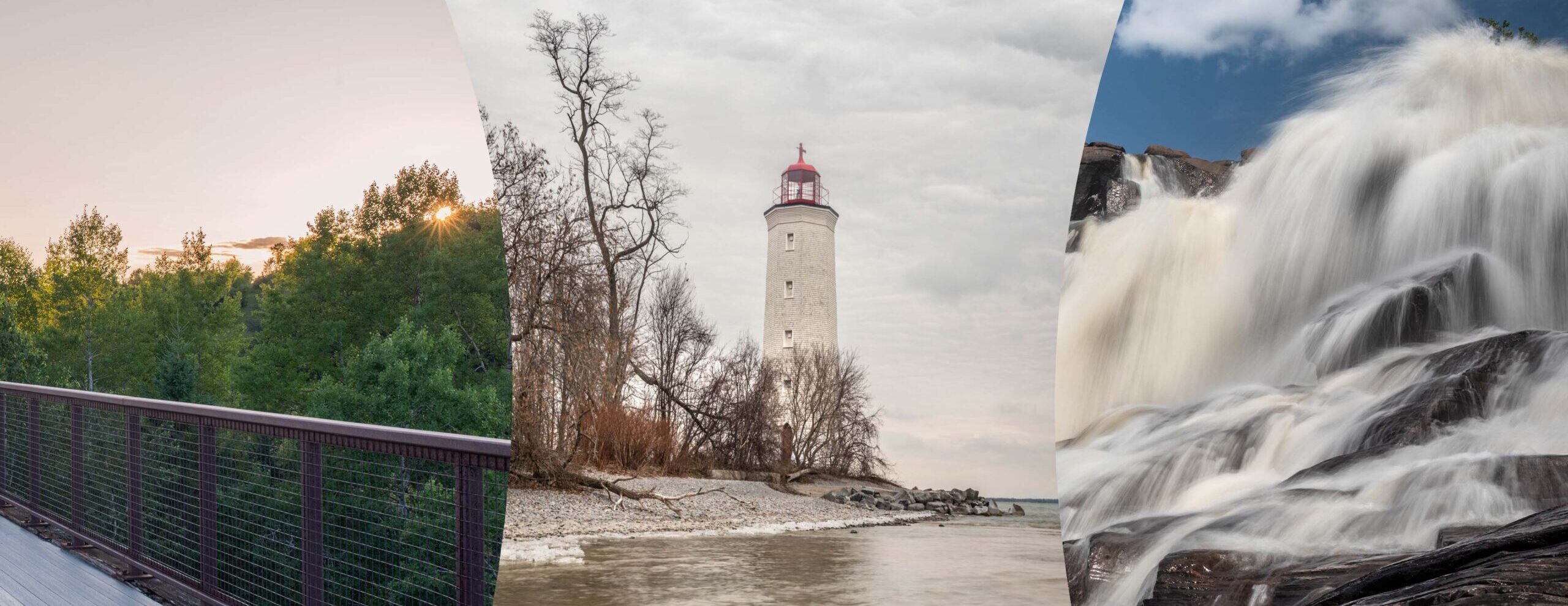
The journey starts at a historic boulder opposite the town hall in Port Hope. This southern terminus is located on the north shore of Lake Ontario, providing a scenic starting point for Ontario hiking trails. The path leads hikers through the Ganaraska Forest, situated on the sandy hills of the Oak Ridges Moraine. In this area, the trail is often characterized by lush forests and rolling hills. It is here that the vision of the Willow Beach Field Naturalists first took root in the early 1960s.
The Kawartha Lakes Exploration
As the trail moves north, it enters the beautiful Kawartha region. The Kawartha Club maintains approximately 77.5 kilometres of the Ganaraska Trail, stretching from Omemee to Moore Falls.
- Terrain: The initial 50 kilometres are relatively flat, skirting the lakes of the Kawartha region.
- Scenery: Hikers are treated to views of drumlin fields and tranquil riverbanks.
- Difficulty: While the southern portion is gentle, the northern 20 kilometres of this section begin to show evidence of the Canadian Shield.
The Challenge of the Wilderness Section
The Wilderness section is widely regarded as the most demanding part of the Ganaraska Trail. Located on the Precambrian shield, this segment connects the southern and northern reaches of the trail.
Note: This section remains a significant challenge to hiking enthusiasts today. It is recommended that this 71.5 km stretch only be attempted by experienced backpackers.
A Deep Dive into the History of Ganaraska Hiking
The Ganaraska Hiking Trail originated with the idea of the Willow Beach Field Naturalists of Northumberland County. Their goal was to provide naturalists with access to the unspoiled countryside of Ontario.
The Ganaraska Hiking Trail was officially opened on April 21, 1968, connecting Port Hope to Lindsay.
Following the official opening, the trail’s expansion was continued by passionate volunteers. Additional sections were established from the Bruce Trail at Glen Huron to Midhurst and from the Wye Marsh to the Copeland Forest after 1969. In the early 1980s, the decision was made by the association to extend the east and west sections further north. These were eventually connected by the formidable wilderness trail across what is now Queen Elizabeth II Wildlands Provincial Park.
The blazing and marking of this section was considered a major challenge. In fact, it was finally completed in the winter by a dedicated team using snowmobiles. In 2000, the association’s name was updated to the Ganaraska Hiking Trail Association Inc. This change was implemented to distinguish the path from equestrian and multi-use trails, ensuring a dedicated experience for those hiking on foot.
Club Activities and Community Involvement
One of the best ways to experience Ontario hiking trails is by joining a local club. The Ganaraska community is active and welcoming to new members.
The Kawartha Club Schedule
Regular outings are organized by the Kawartha Club for members and guests.
- Wednesday Mornings: Short hikes lasting about 1.5 hours.
- Weekends: Longer, more challenging excursions through the Ontario wilderness.
- Summer Break: It should be noted that hikes are generally not scheduled during July and August.
The Wilderness Club Expertise
Because of the challenges posed by the 71.5 km of wilderness terrain, a limited number of hikes are organized by the Wilderness Club. Multi-day backpacking trips are the primary focus here. Maintenance weekends are also held each season to ensure the Ganaraska Trail remains passable for future generations of hikers.
Essential Tips for Your Ontario Hiking Adventure
Safety and preparation are paramount when hiking in Ontario, especially on the Ganaraska.
- Navigation: While the trail is blazed, carrying a GPS and a physical map is strongly advised, particularly in the Wilderness section.
- Water: Water must be filtered before drinking. Stagnant water from beaver ponds is known to plug filters quickly.
- Etiquette: Respect for private property is expected from all hikers, as many stretches of the trail cross private land.
- Safety: Never hike the Wilderness section alone; a buddy system should always be utilized.
As you plan your next trip, remember that the Ganaraska Trail is a privilege provided by the hard work of volunteers and the generosity of landowners. By following the hiker’s code, the beauty of Ontario can be preserved for all.
Conclusion
The Ganaraska Trail is more than just a path; it is a journey through the heart of Ontario. From the historic start in Port Hope to the rugged cliffs of the Canadian Shield, every kilometre offers something new. If you are looking for the best Ontario hiking trails, the Ganaraska should be at the top of your list. The diversity of the landscape and the rich history of the trail association make it a truly unique destination.
Start your adventure on the Ganaraska Trail today and discover the best hiking in Ontario.
Join the Ganaraska Hiking Trail Association to support the maintenance of these beautiful Ontario trails.
Meta Description: Discover the ultimate guide to hiking on the Ganaraska Trail in Ontario. This comprehensive 3000-word blog explores the 500km Ganaraska Trail, from its historic start in Port Hope to the rugged Wilderness section in Queen Elizabeth II Wildlands Provincial Park. Learn about the diverse sections maintained by the Ganaraska Hiking Trail Association, including the Kawartha Lakes and Simcoe regions. We cover the rich history of Ontario hiking trails, essential safety tips for backpackers, and how to join local clubs like the Kawartha Club for guided excursions. Whether you are looking for a gentle walk through the Ganaraska Forest or a multi-day wilderness challenge on the Pre-Cambrian shield, this SEO-optimized guide provides everything you need to know. Experience the best hiking in Ontario and immerse yourself in the natural beauty of the Oak Ridges Moraine and the Canadian Shield on the legendary Ganaraska.