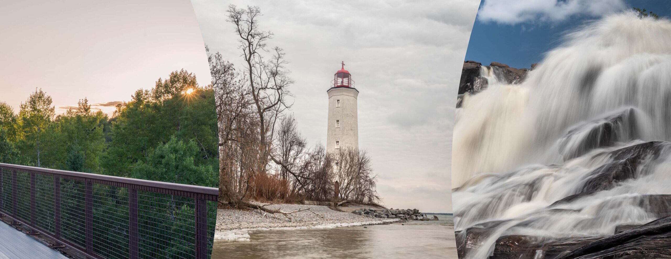
Ultimate Guide to Hiking the Bruce Trail at Rockway Conservation Area on the Niagara Escarpment
Discover the ultimate guide to hiking the Bruce Trail through Rockway Conservation Area on the scenic Niagara Escarpment in Ontario. Experience two spectacular waterfalls, including famous Rockway Falls, plunging from heights of 19.5 meters and 12.2 meters into the Fifteen Mile Creek valley. Explore lush canopy forests filled with mature Basswood, Sugar Maple, Black Walnut, and Sycamore trees alongside historical 1792 salt springs that boast some of the finest salt quality in Ontario. Plan your outdoor adventure with comprehensive details on trail difficulty, terrain navigation, parking off 9th Avenue tablelands, seasonal weather considerations, local flora, and essential gear recommendations for an unforgettable Niagara Escarpment hiking experience. Whether you are a seasoned Bruce Trail trekker or a casual day hiker, this natural sanctuary offers a remote wilderness escape filled with rich geological history, rushing rapids, and breathtaking views.
Hiking through the natural sanctuaries of Southern Ontario offers outdoor enthusiasts an unparalleled glimpse into ancient geological formations, lush hardwood forests, and cascading waterways. Furthermore, among the many treasure troves scattered along the Niagara Escarpment, few locations match the quiet solitude and raw natural magnificence found within the Fifteen Mile Creek valley. A journey along this portion of the Bruce Trail immerses visitors in a landscape carved over millions of years by glacial forces and water erosion. Consequently, hikers seeking a remote wilderness escape complete with plunging waterfalls, historic salt springs, and towering canopy trees will find their expectations exceeded.
Additionally, the Niagara Escarpment stands as a UNESCO World Biosphere Reserve, renowned globally for its dramatic cliff faces, ancient cedar groves, and unique biodiversity. Within this protected corridor, the Bruce Trail serves as Canada’s oldest and longest continuous footpath, guiding adventurers through some of the most ecologically sensitive habitats in North America. In fact, the trail segment running through the Lincoln and St. Catharines region provides direct access to deep gorges where roaring streams cut through dolomite and shale beds. For nature photographers, backcountry hikers, and casual day-trippers alike, this destination provides a classic taste of wild Ontario.
Rockway Conservation Area: The Hidden Gem of the Niagara Escarpment along the Bruce Trail
Rockway Conservation Area: Located in the heart of the Niagara Peninsula, this region is celebrated for its lush vineyards, rolling hills, and rich agricultural heritage. However, beneath the serene surface of wine country lies a rugged corridor shaped by dramatic geological upheaval. The escarpment bedrock was formed hundreds of millions of years ago during the Silurian period when a warm inland sea covered the area. Over millennia, layers of sediment were compacted into hard dolostone and softer underlying shale. As water eroded the softer rock beneath, massive cliff faces collapsed, giving rise to the steep ridges, talus slopes, and deep ravines that define the region today.
Consequently, trekking along the Bruce Trail in this sector demands both stamina and careful footwork. The main trail meanders through rugged terrain where exposed tree roots and moss-covered limestone boulders line the path. Furthermore, seasonal changes dramatically alter the landscape. In early spring, snowmelt transforms quiet creek beds into surging torrents of whitewater that thunder over rock shelves. During autumn, the forest canopy transforms into a vivid palette of crimson, gold, and orange, attracting hikers from across Ontario. Meanwhile, summer offers cool shade under dense leaf cover, and winter coats the canyon walls in glittering icicles and frozen mist.
+-------------------------------------------------------------------------+
|                  NIAGARA ESCARPINES ECOSYSTEM HIGHLIGHTS                |
+-------------------------------------------------------------------------+
|  Geological Era   | Silurian Period (approx. 400-440 Million Years Ago) |
|  Primary Rocks    | Lockport Dolostone (Top layer), Rochester Shale     |
|  Trail System     | Bruce Trail Main Path & Local Side Trails           |
|  Key Features     | Gorges, Waterfalls, Salt Springs, Old-Growth Trees  |
|  Conservation     | Niagara Peninsula Conservation Authority (NPCA)     |
+-------------------------------------------------------------------------+
Why Rockway Conservation Area is a Must-Visit Niagara Hiking Destination
Rockway Conservation Area is part of the Niagara Escarpment and offers history and beauty in a remote setting. Managed by the Niagara Peninsula Conservation Authority (NPCA), this 126-hectare natural zone remains one of the region’s most pristine environments. While larger parks often attract heavy crowds, this conservation area provides a quieter, more authentic encounter with nature. Indeed, visitors can trek down into deep river valleys where the sounds of highway traffic fade, replaced entirely by rustling foliage, chirping songbirds, and rushing water.
Moreover, the area is historically significant due to early industrial endeavors and human settlement dating back to the late 18th century. Early European settlers recognized the valley’s valuable resources, including timber, water power, and mineral-rich springs. Today, structural remnants of old mills and historic roads can still be observed by attentive hikers as they navigate the forest floor. Furthermore, environmental preservation efforts ensure that these historic landmarks exist in harmony with surrounding wildlife habitats, creating a living museum where natural history and human heritage intersect.
Rockway Conservation Area on the Niagara Escarpment features Bruce Trail hiking through Fifteen Mile Creek valley past 19.5m and 12.2m waterfalls, mature hardwood forests, and historic 1792 salt springs.
                            [ Escarpment Tablelands ]
                                       |
                   +-------------------+-------------------+
                   |                                       |
         (9th Avenue Parking)                     (Bruce Trail Access)
                   |                                       |
                   +-------------------+-------------------+
                                       |
                             [ Upper Rockway Falls ]
                               (19.5m Water Plunge)
                                       |
                          [ Fifteen Mile Creek Valley ]
                          (Basswood, Maple, Walnut, Sycamore)
                                       |
                             [ Lower Rockway Falls ]
                               (12.2m Waterfall)
                                       |
                            [ Historic Salt Springs ]
                             (Established c. 1792)
                                       |
                           [ Surging Downriver Rapids ]
The Magnificent Waterfalls of Fifteen Mile Creek
Waterfalls are undoubtedly the primary highlight for visitors exploring this section of the Niagara Escarpment. As Fifteen Mile Creek cuts through the escarpment bedrock, two spectacular waterfalls plunge from heights of 19.5 meters and 12.2 meters. The upper drop, commonly referred to as Rockway Falls, features a wide crest where water flows dramatically over a hard limestone shelf before plunging into a broad amphitheater bowl. During heavy rainfall or peak spring thaw, the sheer force of the falling water creates an imposing roar that echoes throughout the canyon walls.
+-------------------------------------------------------------------------+
|                         WATERFALL COMPARISON TABLE                      |
+-------------------------------------------------------------------------+
| Feature               | Upper Rockway Falls     | Lower Rockway Falls   |
+-----------------------+-------------------------+-----------------------+
| Drop Height           | 19.5 Meters (64 Feet)   | 12.2 Meters (40 Feet) |
| Water Source          | Fifteen Mile Creek      | Fifteen Mile Creek    |
| Cascade Type          | Plunge / Ramp           | Step / Cascade        |
| Surrounding Rock      | Lockport Dolostone      | Rochester Shale       |
| Accessibility         | Lookout Platform / Trail| Ravine Hike Path      |
+-----------------------+-------------------------+-----------------------+
In addition, a short distance downriver lies the lower waterfall, measuring 12.2 meters in height. The watercourse continues downriver, surging over a series of rapids. This secondary drop is framed by steep shale banks and dense foliage, making it a favorite spot for wilderness photography. As the water cascades over step-like rock layers, smaller chutes and pools are formed along the creek bed. Consequently, hikers are treated to a dynamic display of moving water throughout their entire journey down the valley floor.
Rich Botanical Diversity: Flora of Fifteen Mile Creek Valley
Hike the trail into the Fifteen Mile Creek valley to experience mature Basswood, Sugar Maple, Black Walnut and Sycamore trees. The microclimate created by the deep valley walls shields delicate plant species from harsh winds while maintaining high humidity levels. Consequently, an impressive canopy is formed by ancient hardwood trees, some of which have stood for over a century. Furthermore, during late spring and early summer, sunlight filters through the high canopy, casting dappled light across carpeted forest floors covered in native ferns, trilliums, and wild ginger.
+-------------------------------------------------------------------------+
|                   KEY TREE SPECIES OF ROCKWAY VALLEY                    |
+-------------------------------------------------------------------------+
| Species Name       | Identification Features    | Ecological Role       |
+--------------------+----------------------------+-----------------------+
| Sugar Maple        | Broad 5-lobe leaves, dark  | Deep shade canopy,    |
| (Acer saccharum)   | furrowed bark              | autumn color display  |
|                    |                            |                       |
| American Basswood  | Heart-shaped leaves, soft  | Pollinator habitat,   |
| (Tilia americana)  | light wood                 | fertile soil biomass  |
|                    |                            |                       |
| Black Walnut       | Compound leaves, dark      | Wildlife food source  |
| (Juglans nigra)    | deeply ridged bark         | (Squirrels/Rodents)   |
|                    |                            |                       |
| American Sycamore  | Flaking mottled bark,      | Riverbank stability,  |
| (Platanus occidentalis) | massive broad trunks   | erosion control       |
+--------------------+----------------------------+-----------------------+
Importantly, the presence of American Sycamore trees along the creek edges is indicative of healthy riparian zones. These trees are easily recognized by their distinct, camouflage-like bark that flakes off in puzzle-like patches, revealing smooth white and gray wood beneath. Meanwhile, Sugar Maples dominate the higher slopes, offering vital habitat for native birds and woodland mammals. Furthermore, fallen logs and decomposing leaf litter are utilized by rare fungi, salamanders, and woodland insects, maintaining a rich food web across the entire conservation reserve.
Historic Salt Springs: Ontario’s Early Industrial Legacy
Boasting some of the best quality and quantity of salt in Ontario, the salt spring dates as far back as 1792. During the late 18th and early 19th centuries, salt was one of the most critical commodities for pioneer life, used primarily for preserving meat and curing hides. Prior to major commercial trade networks, local salt springs were highly prized by early settlers and Indigenous communities. Indeed, small-scale boiling operations were established at Rockway to evaporate the brine and extract pure salt crystals.
Furthermore, historical records indicate that the brine produced from these underground springs contained an exceptionally high mineral concentration compared to other regional sources. Although commercial operations eventually ceased when larger salt deposits were discovered in Southwestern Ontario, the spring remains a point of historic interest along the hiking route. Today, as hikers pass near the spring site along Fifteen Mile Creek, mineral encrustations can still be seen along the rocks, serving as a silent reminder of Ontario’s early pioneer economy.
Detailed Hiking Directions and Bruce Trail Trailhead Navigation
Area facilities include limited parking off 9th Avenue on escarpment tablelands. To begin your excursion, navigate toward the parking area situated near 3189 Ninth Street in St. Catharines / Lincoln. Because space is restricted, early morning arrivals are strongly recommended, especially on summer and autumn weekends. Once parked, hikers will find trail entry signs and informational map kiosks near the tree line.
+-------------------------------------------------------------------------+
|                       TRAIL NAVIGATION SUMMARY                          |
+-------------------------------------------------------------------------+
| Parameter            | Metric / Specification                           |
+----------------------+--------------------------------------------------+
| Main Trail Length    | Approx. 1.8 km (Connects to Main Bruce Trail)    |
| Trail Markers        | White Blazes (Main Trail) / Blue Blazes (Side)   |
| Difficulty Level     | Moderate to Challenging (Steep ravine descents)  |
| Terrain Type         | Earth path, loose talus, exposed roots, rocks    |
| Accessibility        | Granular accessible lookout trail available top  |
+----------------------+--------------------------------------------------+
From the trailhead, the main Bruce Trail route is marked by standard white painted blazes on tree trunks and posts. Following these white blazes leads hikers past the upper gorge lookout platform before descending into the valley bottom. Alternatively, blue-blazed side trails offer loop options for those wishing to explore the lower reaches of Fifteen Mile Creek without completing a full point-to-point trek. Moreover, proper footwear with aggressive tread is required, as damp clay and smooth river stones can become extremely slippery after rainfall.
+-------------------------------------------------------------------------+
|                    STEP-BY-STEP HIKING GUIDE ROUTE                      |
+-------------------------------------------------------------------------+
| Step 1: Park at the 9th Avenue trailhead parking lot (Escarpment top)   |
| Step 2: Access the lookout point for Upper Rockway Falls (19.5m drop)   |
| Step 3: Follow white Bruce Trail blazes down the east rim side          |
| Step 4: Traverse Fifteen Mile Creek valley floor under Sycamore canopy  |
| Step 5: View Lower Rockway Falls (12.2m) and historical salt springs    |
| Step 6: Loop back via blue side trail or continue along main Bruce Trail|
+-------------------------------------------------------------------------+
Seasonal Hiking Considerations in the Niagara Escarpment
Each season brings a completely distinct character to hiking trails along the Niagara Escarpment. In spring, high water volume ensures that both Rockway Falls and the downstream rapids are operating at peak flow. However, muddy conditions are prevalent along low-lying creek paths, making waterproof boots and trekking poles essential gear. Additionally, spring wild flowers bloom rapidly across the forest floor before tree leaves fully emerge, offering incredible botanical viewing.
+-------------------------------------------------------------------------+
|                    SEASONAL TRAIL CONDITIONS MATRIX                     |
+-------------------------------------------------------------------------+
| Season | Water Volume | Trail Conditions     | Key Highlights           |
+--------+--------------+----------------------+--------------------------+
| Spring | High / Peak  | Muddy, high creek    | Roaring falls, blooms    |
| Summer | Low / Moderate| Dry, shady canopy   | Dense forest cover       |
| Autumn | Moderate     | Crisp, leaf covered  | Spectacular foliage      |
| Winter | Variable     | Icy, snow covered    | Ice formations, solitude |
+--------+--------------+----------------------+--------------------------+
Conversely, summer transforms the trail into a cool, green canopy, providing relief from scorching temperatures. While creek water levels may decrease during dry August spells, the deep shade provided by mature Basswood and Maple trees makes hiking comfortable. Autumn is widely considered the prime hiking season in Ontario, as fall foliage lights up the valley walls in radiant tones. Finally, winter hiking reveals wide-open views through bare trees, though crampons or microspikes are strictly necessary when ice accumulates on steep valley slopes.
Safety, Gear, and Leave-No-Trace Principles
Safety must always remain a top priority when navigating escarpment terrain. Because cliff edges are unfenced in many areas, hikers must maintain a safe distance from sudden vertical drops. Furthermore, climbing on waterfall rock faces or entering deep gorge pools is strongly discouraged, as loose shale and moss-covered dolostone present severe slip hazards.
+-------------------------------------------------------------------------+
|                       ESSENTIAL HIKING PACK LIST                        |
+-------------------------------------------------------------------------+
| Gear Category       | Recommended Items                                 |
+---------------------+---------------------------------------------------+
| Footwear            | Sturdy hiking boots with ankle support            |
| Navigation          | Bruce Trail Map / Offline GPS App / Compass       |
| Hydration & Snacks  | Minimum 2 Liters of water, high-energy snacks     |
| Clothing            | Layered synthetic/merino wool, rain shell         |
| Tools & Safety      | Small first aid kit, headlamp, trekking poles     |
+---------------------+---------------------------------------------------+
In addition, practicing Leave-No-Trace ethics guarantees that this fragile ecosystem remains preserved for future generations. All trash, including organic fruit peels, must be packed out. Furthermore, picking wild plants, disturbing wildlife, or removing mineral samples is prohibited. By staying strictly on marked paths, soil erosion is minimized, and rare plant communities along sensitive trail edges are protected.
Exploring Surrounding Attractions in the Niagara Peninsula
After completing your trek through Fifteen Mile Creek valley, the surrounding Niagara region offers numerous attractions to extend your day trip. Located just minutes away, historic downtown Jordan Village features boutique shops, artisan bakeries, and local dining options. Furthermore, the area is home to world-class estate wineries situated along the Twenty Mile Bench, where visitors can enjoy tastings overlooking vineyards framed by the Niagara Escarpment.
+-------------------------------------------------------------------------+
|                  NEARBY NIAGARA ESCARPMENT ATTRACTIONS                  |
+-------------------------------------------------------------------------+
| Attraction Name           | Distance | Highlights                       |
+---------------------------+----------+----------------------------------+
| Ball's Falls Conservation | 10 mins  | Historic 19th-century village    |
| Louth Conservation Area   | 5 mins   | Secluded gorge hike & falls      |
| Jordan Village            | 10 mins  | Fine dining, cafes, artisan shops|
| Twenty Mile Bench Wine Hub| 10 mins  | Award-winning cool-climate wine  |
+---------------------------+----------+----------------------------------+
Moreover, outdoor enthusiasts can explore additional nearby conservation sites, such as Ball’s Falls Conservation Area or Louth Conservation Area, both of which feature Bruce Trail connections and historic mills. Consequently, combining a hike at Rockway with visits to neighboring natural areas creates an ideal full-day itinerary for exploring Ontario’s natural beauty.
Rockway Conservation Area on the Niagara Escarpment offers an unforgettable Ontario hiking experience along the Bruce Trail past roaring waterfalls and historic salt springs.
Exploring Fifteen Mile Creek valley at Rockway Conservation Area rewards hikers with views of Rockway Falls, rich hardwood forests, and ancient escarpment tablelands.
Written By
Tom Worsley
Ontario trail hiker and outdoor photographer
This trail guide is based on first-hand visits and on-site observations documented by Tom Worsley.
View full author bio